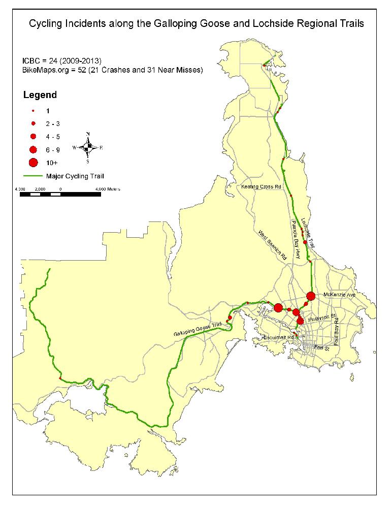
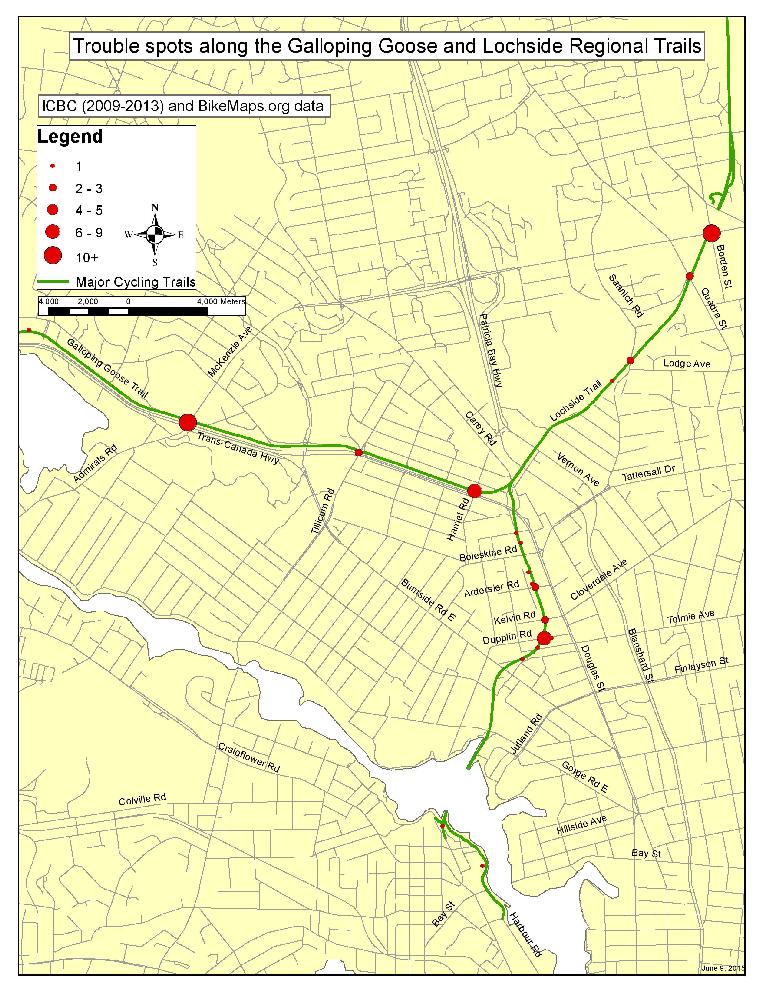
We love riding the Galloping Goose Regional Trail, but there are a few trouble spots. Citizens mapping to BikeMaps.org have highlighted the four worst intersections:
Hwy 1 & McKenzie Ave
Galloping Goose & Harriet Rd
Galloping Goose & Dupplin Rd
McKenzie Ave & Borden St
The most problematic locations are where the trail intersects with vehicle traffic, but on the two maps below you can see several areas where issues are occurring between cyclists or with other trail users. The BikeMaps.org research team from UVic has launched a study of safety along the Galloping Goose Regional Trail. You can help! Add your own data on crashes, near misses, and hazards at BikeMaps.org.