BikeMaps.org
  • Home
  • Visualization
  • Blog
  • About
  • Español
  • Français
  • Íslenska
  • Guest
    • Log in
    • Register

BikeMaps Blog

  • Jun 10

    BikeMaps.org Mobile App Now Available

    Jun 10
    Tweet

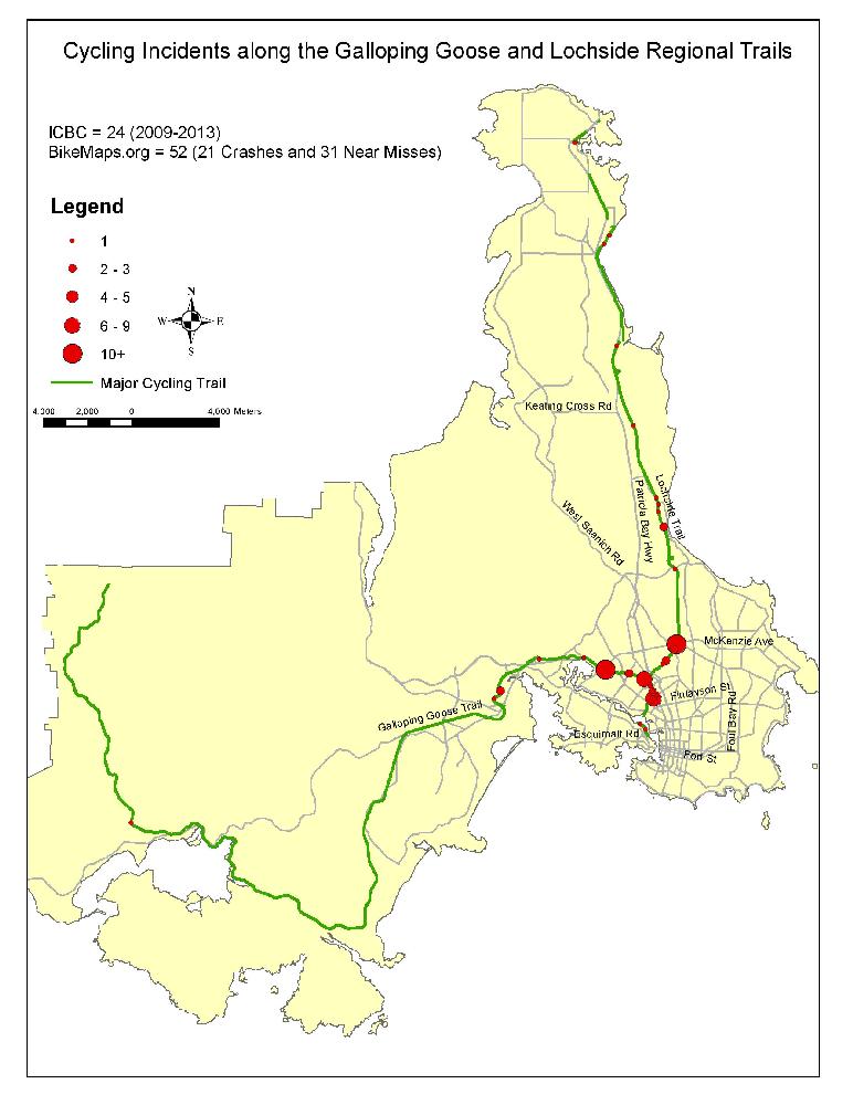
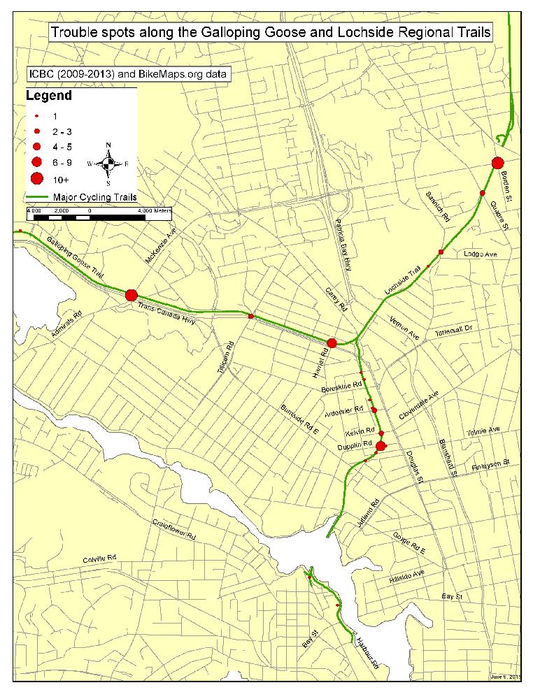
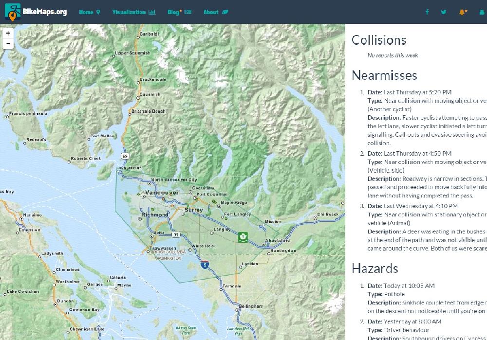
    The BikeMaps.org team is excited to announce that the mobile app for Android devices is now available on Google Play. The easiest way to download the app is to launch the Play Store app directly on your Android device, perform a search for "BikeMaps.org" (make sure to include the .org), select the BikeMaps.org app from the search results, and install. Alternatively, if you have your phone or mobile device linked with your Google account, you can use your computer to browse to the BikeMaps app listing on Google Play , log in, and install the app. Watch for the iOS version, which should be available in July.

    Mobile app photo2

  • Jun 9

    BikeMaps.org highlights trouble spots on the Galloping Goose Regional Trail, Victoria, Canada

    Jun 9
    Tweet

    We love riding the Galloping Goose Regional Trail, but there are a few trouble spots. Citizens mapping to BikeMaps.org have highlighted the four worst intersections:

    1. Hwy 1 & McKenzie Ave
    2. Galloping Goose & Harriet Rd
    3. Galloping Goose & Dupplin Rd
    4. McKenzie Ave & Borden St
    The most problematic locations are where the trail intersects with vehicle traffic, but on the two maps below you can see several areas where issues are occurring between cyclists or with other trail users. The BikeMaps.org research team from UVic has launched a study of safety along the Galloping Goose Regional Trail. You can help! Add your own data on crashes, near misses, and hazards at BikeMaps.org.

    allgoose

    smallG

  • Jun 2

    Monitor BikeMaps.org where you ride

    Jun 2
    Tweet

    Want to know what citizens have been mapping in riding area or city? By creating a BikeMaps.org login and defining an alert area you can track reports in areas that interest you.

    How?

    1. Register as a user or login - see the upper right corner of the website.
    2. Use the tool to define an area of interest to you.
    3. Click the tool (near the login) to see what has been mapped in the last week.

    Recent reports

  • May 21

    Beware: 8 cycling safety hot spots in Victoria, BC

    May 21
    Tweet

    On the BikeMaps.org website, citizens of Victoria (Canada) have mapped more than 475 trouble spots for cyclists. Below are top 8 problem areas they report. Drivers and cyclists should use caution at these locations. Interested in safety in your area? Encourage local mapping!

    Key Areas highlighted:
    • A) Mckenzie and Hwy 1
    • B) Galloping Goose between Ardersier Rd and Burnside Rd East
    • C) Johnson St Bridge
    • D) Landsdowne Rd between Richmond and Foul Bay Rd
    • E) Fort St and Foul Bay Rd
    • F) Quadra St between Pandora Ave and Courtney St
    • G) Harriet Rd and Highway 1
    • H) Cook St and Bay St

      Problem Map

« Newer posts